Map
Use a map to see where records are located, place records that don't have coordinates, and compare several location-based datasets in one workspace.
Understand a map
A map plots records from a collection using one location field. A record with coordinates appears as a marker or shape. A record without coordinates stays under No place until you assign it a location.
The map can also pin records from other collections and add collection layers without changing the map's main dataset.
Choose what the map plots
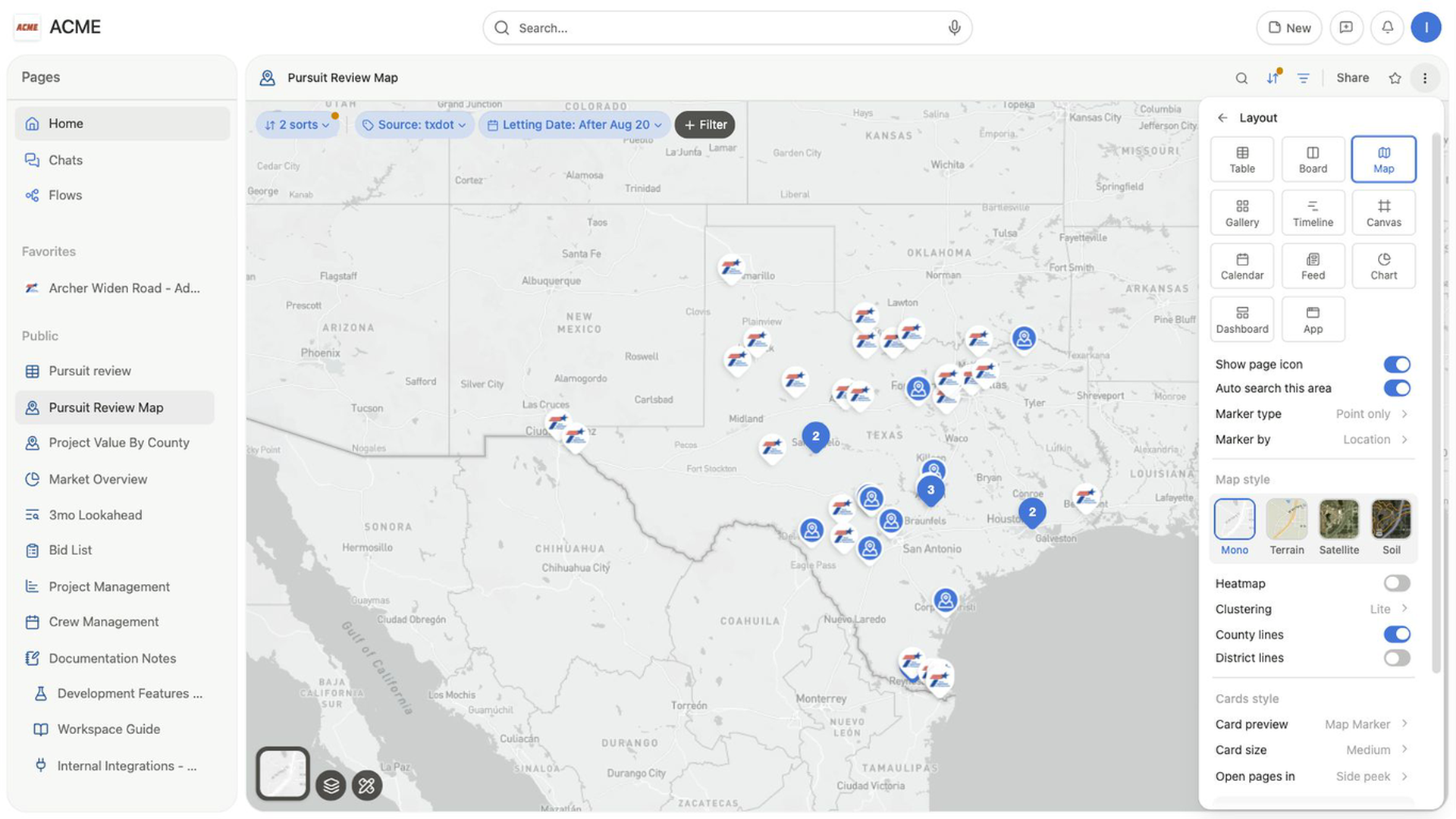
Open the view settings menu, select Layout, and configure:
- Under
Marker type, choosePoint onlyorShape (Polygon/Route). - Under
Marker by, choose the location field. - Under
Map style, chooseMono,Terrain,Satellite, orSoil. - Choose
Clusteringwhen several point markers overlap.
The map redraws from the selected location field.
Map layout settings also include County lines, District lines, `Card preview, Card size, Open page in, and Load limit`.
Place a record from No place
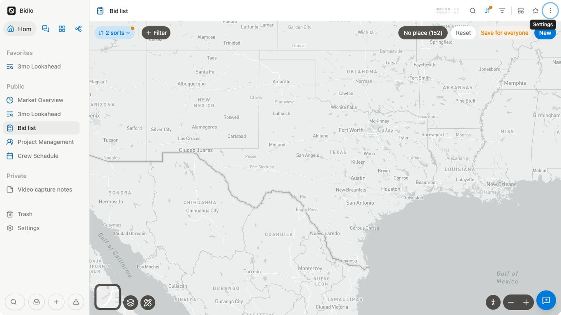
No place lists records that are part of the view but don't have coordinates in Marker by.
- Select
No place. - Search for the record if needed.
- Drag the record from the list onto the map.
- Drop it where the marker belongs.
Bidlo saves those coordinates in the selected location field. The record leaves No place and appears on the map.
Add records, shapes, lines, and pins
Select New in the map action bar to open Add to Map.
New {collection}creates a record and lets you place it on the map.Draw shapecreates a polygon annotation.Add linecreates a route or line annotation.Drop pincreates a point annotation.Search things to add...finds an existing record. If it already has coordinates, Bidlo pins it immediately; otherwise, Bidlo asks you to place it.
After choosing a new point, select the map to place it. Shape and line modes open drawing controls so you can finish the geometry.
Open, pin, and move a marker
Hover over a marker to preview its record. Select the marker or its preview to open the record according to Open page in.
For map-specific actions, open the marker's context menu:
Move markerarms the marker for dragging.Pinkeeps the record on this map.Unpinremoves that explicit pin from the map.View Street Viewopens the location at street level.Measure from here,Soil survey here, andTravel range from herestart a tool at that marker.
Markers are fixed until you choose Move marker. After the action is armed, drag the marker to its new location.
Change the map style and density
Use the map-style thumbnail at the lower left to switch between Mono, Terrain, Satellite, and Soil.
The same menu controls:
Heatmapto show location density or weight records byMeasure by.ClusteringwithNone,Lite, orAggressivewhen heatmap is off.County linesandDistrict lines.
Add and manage layers
Layers place another configured set of records on top of the current map.
- Open
Layersat the lower left. - Select
Add layer. - Choose a collection, a saved layer, or
New empty layer. - Configure the layer's fields, filters, sorts, and load limit.
The layer appears alongside the map's main records. Open Layers again to:
- Hide or show a layer without removing its setup.
- Rename the layer or change its icon.
- Add a new record to the layer.
- Save the layer for reuse.
- Remove the layer from this map.
- Select
Save this map as a layerto reuse the main map configuration.
Use map tools
Open Map tools at the lower left to choose:
Soil SurveyMeasure distanceTravel RangeHaul Advantage
Use the separate Street View control at the lower right, then select a point on the map. The Zoom out and Zoom in controls sit beside it.
Each tool opens its own on-map controls or work card. Close the tool when you're ready to return to normal marker interaction.
Keep the map centered on your work
Auto search this area keeps the map's location sort aligned with the area you move to. When it is on and you pan the map far enough, Bidlo updates the location used by the sort.
Turn it off when you want to explore the map without changing the sorted search area.
Related pages
- Views overview
- Filter, sort, and group
- Export map data as KML
- Compare nearby projects and facilities on a map
FAQs
Why is a record under No place?
The field selected under Marker by does not contain usable coordinates for that record. Add a location or choose the correct location field.
Does pinning a record add it to the map’s main collection?
No. A pinned record can come from another collection and is displayed on the map without being added to the main dataset.