Project & facility maps
Use a project's location to understand nearby work and facilities before you plan coverage, travel, or material sourcing.
Before you start
Open a project that has a mapped location. Nearby results depend on the project and comparison records having valid locations.
Open the project map
- Open the project you want to review.
- Find the project map and select
Interact. - Select
Map layers. - Select
Add layer.
The layer picker suggests both Projects and Facilities. Each layer adds located records alongside the current project without changing the underlying records.
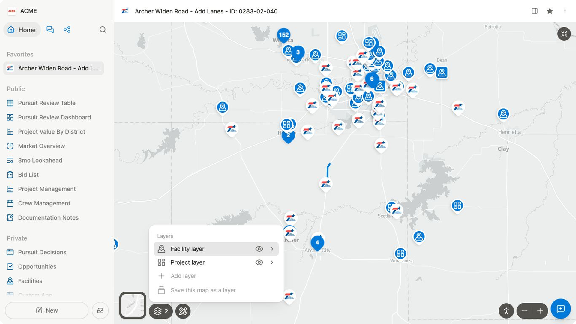
Compare nearby projects
- In the layer picker, select
Projects. - Use the layer filters to narrow the comparison to the dates, geography, or other project fields that matter to your review.
- Pan or zoom the map to inspect the area around the current project.
- Open a project marker when you need its dates, owner, items, or bidder details.
- Return to the original project before making a project-specific decision.
Nearby projects are useful for recognizing work in the same area. They do not rank opportunities or determine whether your team should bid.
Compare nearby facilities
- Select
Map layers→Add layer. - Select
Facilities. - Use the layer filters when you need a specific facility type, company, or other available field.
- Review the facilities shown around the project.
- Open a facility when you need the details stored on its record.
- Confirm the facility location and current operating details through your team's normal process before using it in an estimate.
Facilities and Materials are separate collections in Bidlo. This map brings location context into the project workflow; it does not combine those collections or create a separate facilities workflow.
Use a full Map view for a broader comparison
Open or create a Map view when you need to filter a larger set of records, add saved layers, or work across an area rather than from one project. A Map view can show only records with usable location data.
Straight-line distance, map position, and travel-range tools are planning aids. They are not promised haul routes, travel times, material availability, or costs. Verify the source record and route assumptions before relying on them in an estimate.
If nearby results are missing
- Confirm that the current project has a valid location.
- Check whether the comparison records also have locations.
- Clear filters that may exclude the records you expect.
- Use a full Map view to confirm whether the records can be plotted.
Related pages
FAQs
Why are nearby projects or facilities missing?
Nearby results require usable locations on both the current project and the comparison records. Check their location fields first.
Does adding a map layer combine the underlying collections?
No. A layer displays located records together for comparison without merging collections or changing their records.